
By Christine Graf
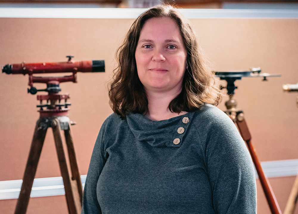
It was while attending Paul Smith’s College in the Adirondacks that Darrah Land Surveying’s Kristin Darrah developed an interest in becoming a land surveyor. After meeting some neighbors who worked in the field, she changed her major from environmental studies to surveying technology.
“I had never even heard of land surveying,” said Darrah. “I observed them working on one of their projects– hand drafting a topographic map. I thought it was really interesting.”
The field of land surveying has a rich history, George Washington, Thomas Jefferson, and Abraham Lincoln all having worked as land surveyors. The famous duo of Meriwether Lewis and William Clark created close to 140 maps while surveying the Louisiana Purchase and the Pacific Northwest.
Land surveying draws heavily on mathematical principles, the fundamentals of geometry being of particular importance, used to calculate angles, distances, and elevations.
Surveyors must also familiarize themselves with local history, especially in the Adirondack region where land patents date back to before the Revolutionary War. A land patent is a document that assigns official ownership of a particular tract of land.
“The goal of what we do is to reproduce the work of the original surveyors—figuring out what their intention was. There’s a lot of history involved in order to understand how the land was split up to begin with,” said Darrah.
Working in the profession since 2002, Darrah joined Darrah Land Surveying in 2007. The company was established in 2006 by her husband, Donald Darrah.
“I became a partner in 2011,” she said. “I wear a lot of hats, overseeing project managers , technicians, field staff, and our administrative staff.”
Based in Lake Luzerne, Darrah Land Surveying has 14 employees and offers a variety of services to its customers.
“We do a little bit of anything. We do construction layout for new buildings, new homes, and subdivisions. We do some heavy highway work for some local construction companies. We also do boundary surveying and design mapping for upgrades to sewer systems or upgrades to municipal properties,” said Darrah.
As a certified New York State Certified Women Business Enterprise (WBE), the firm works on many publicly-funded municipal projects.
“Publicly-funded projects have a minority component requirement for a certain percentage of it to be handled by a minority-owned business, and that’s us,” Darrah explained. “That helps us get our foot in the door on a lot of municipal projects. We just did layout for the Glens Falls Farmers’ Market. We also have the contract with Warren County, working on road projects with the Department of Public Works.”
According to Darrah, boundary surveying represents a significant portion of the firm’s work. Used to determine property lines, these surveys are sometimes necessitated by property-related disputes between neighbors. Regardless of the circumstances, the process begins with a deed analysis.
“If I go to your house and survey your property, we look at your deed, and we look at the deeds for all of the lots that adjoin you– ones that you share a boundary with. We do research at the county clerk’s office and get copies of those deeds. We look for any filed maps that may exist, ones that could affect your property or your neighbor’s property,” she said.
They also look at their internal records which include records purchased from several local surveyors who worked throughout the region. In the field of surveying, it is common to purchase records from surveyors who are retiring. Most recently, the firm purchased the records from Dennis Dickinson in Lake George.
“Essentially, we are buying information,” said Darrah. “In Dennis’ case, it was about 40 years’ worth of work.”
After researching deeds and scouring internal records, Darrah said field crews are sent to the site.
“We recover any existing markers that are called for in the deed or shown on the map so that we can reproduce the intention of the property. We look for iron pins, stone walls, fences, or whatever it happens to be. It’s however the property was described when it was sold. We are trying to reproduce that to the best of our abilities,” she explained.
According to Darrah, property owners are sometimes surprised by the results of a survey.
“Most people have some sort of preconceived idea of where their property boundaries,” she said. “Some of them are far off, and they should have called us before they put that addition on their house. It does happen from time to time.”
In those instances, she said the homeowner may be able to work with their neighbor to fix the issue.
“Hopefully you have really nice neighbors and have the ability to do a lot line adjustment or an easement or something to fix the issue,” she said.
Before purchasing a property, Darrah recommends obtaining a land survey, even if a lender does not require one.
“It’s a really good idea to get a survey when you are buying a property so that you know what you are actually buying,” she noted.
Land surveying is a male dominated profession, with Darrah estimating that women represent less than 25 percent of the field. Earlier in her career, it was often assumed that she was the firm’s secretary, something that now happens only occasionally.
With fewer people pursuing careers in surveying, her firm is finding it increasingly difficult to fill open positions. Not all positions require the individual to become licenses as a land surveyor.
“Land surveying is a field that is shrinking,” said Darrah. “Every company in this area is looking for people. It’s hard to find people who want to do this work because most of the entry-level people are going to be working in the field. It’s hard work. It’s a physical job, but it’s something you can make a career out of whether you get licensed or not. We can train people from the ground up.”